Cyprus Maps
In spring I visited Cyprus. After settling into the hotel, I went looking for a moped to rent. Once I found one, I tried to get maps so it would be clear where the most interesting places were and where to go.
I could not get them right away - the tourist information centers were closed for the holidays. At first I had to ride around using, frankly, fairly poor maps from the hotel.
When I finally got to the tourist center, I was pleasantly shocked by the quality of the maps, and also by the fact that they were available in several languages. The maps had no advertising, a pleasant color palette, scale, and roads.
I brought them back to scan and put online - surely someone looks for maps before a trip, just as I had.
While looking for a cheaper wide-format scanner, I found a site (mapsofcyprus.co.uk) where the maps had already been posted.
I will put some of them here.
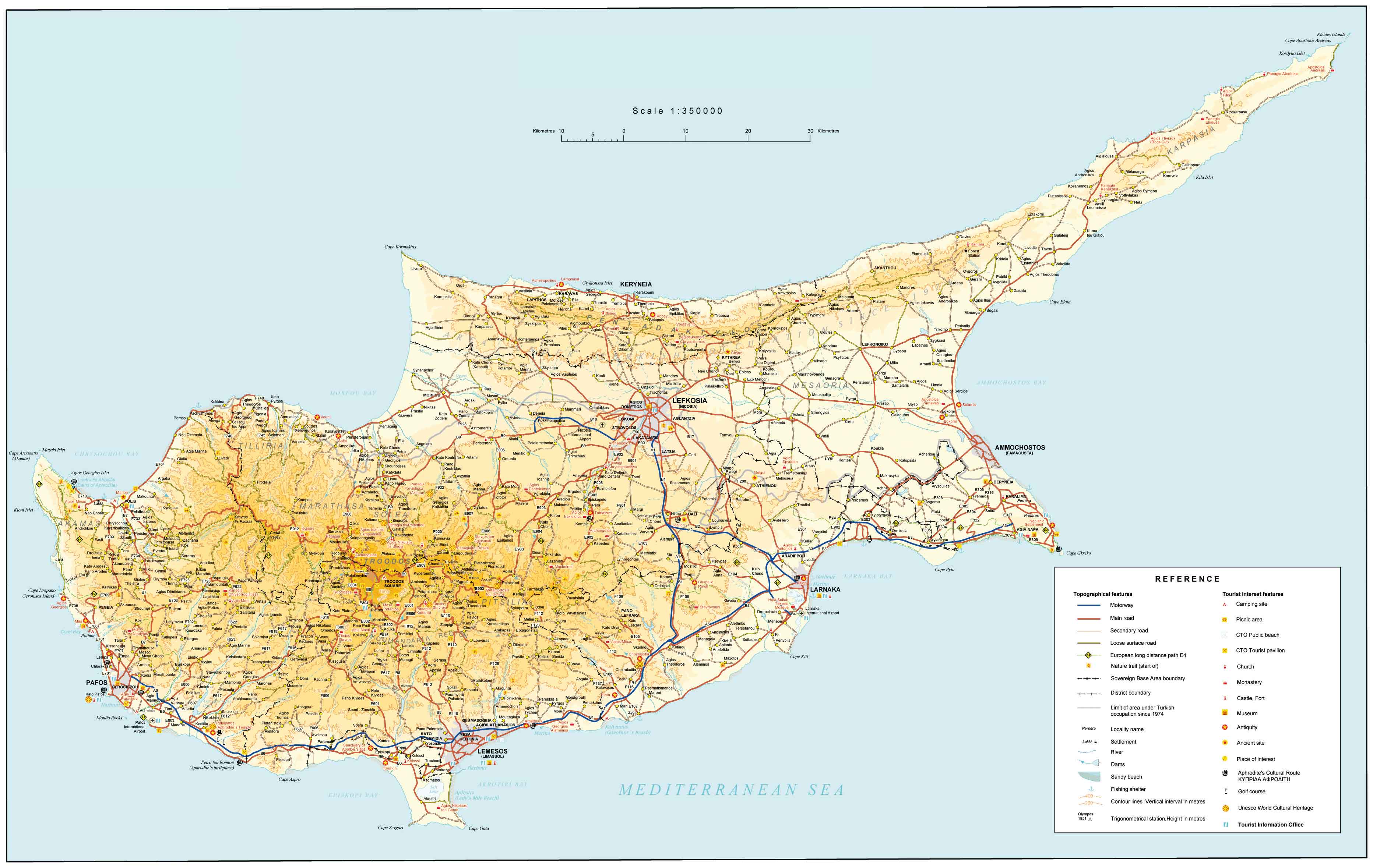
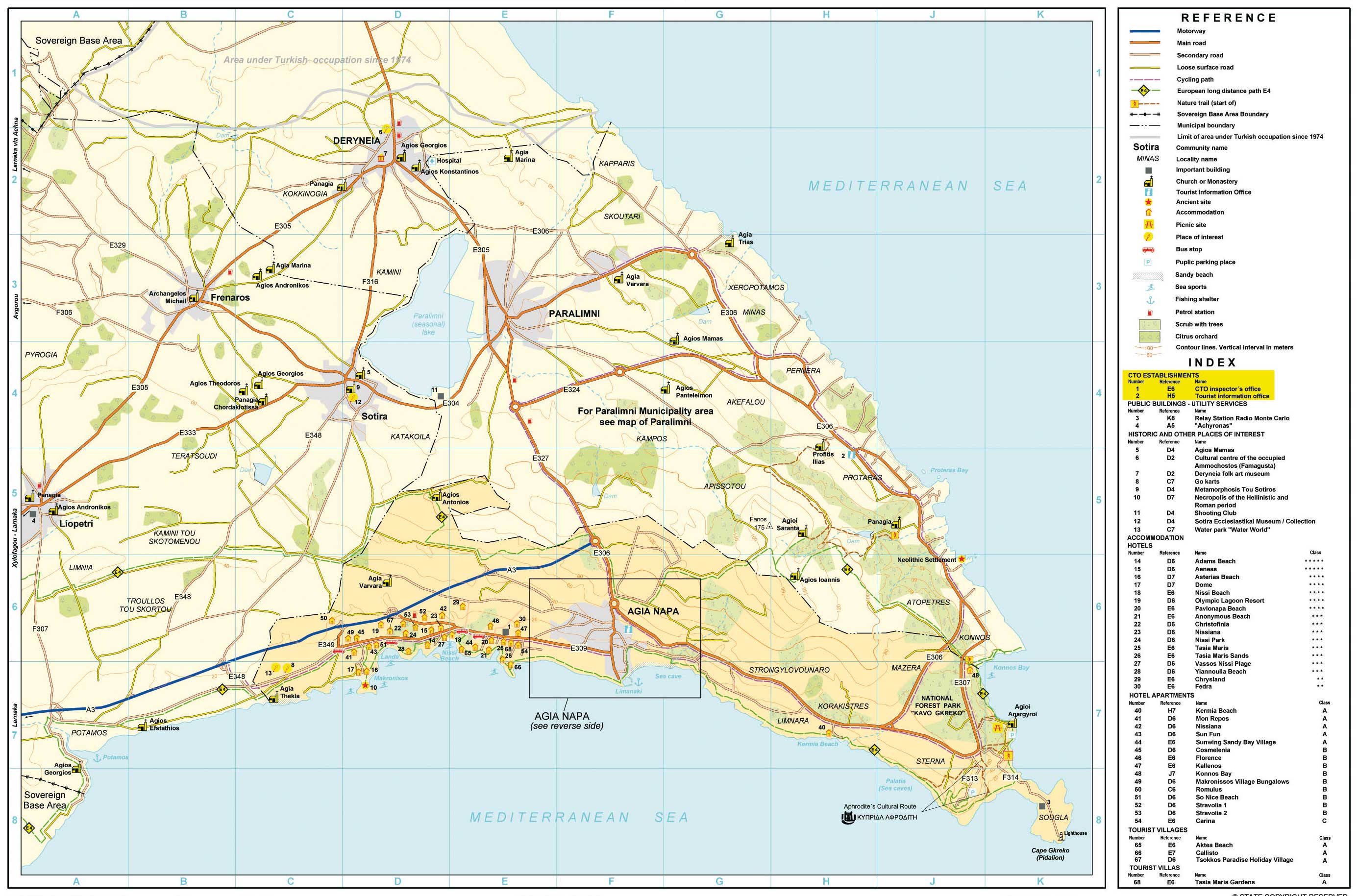
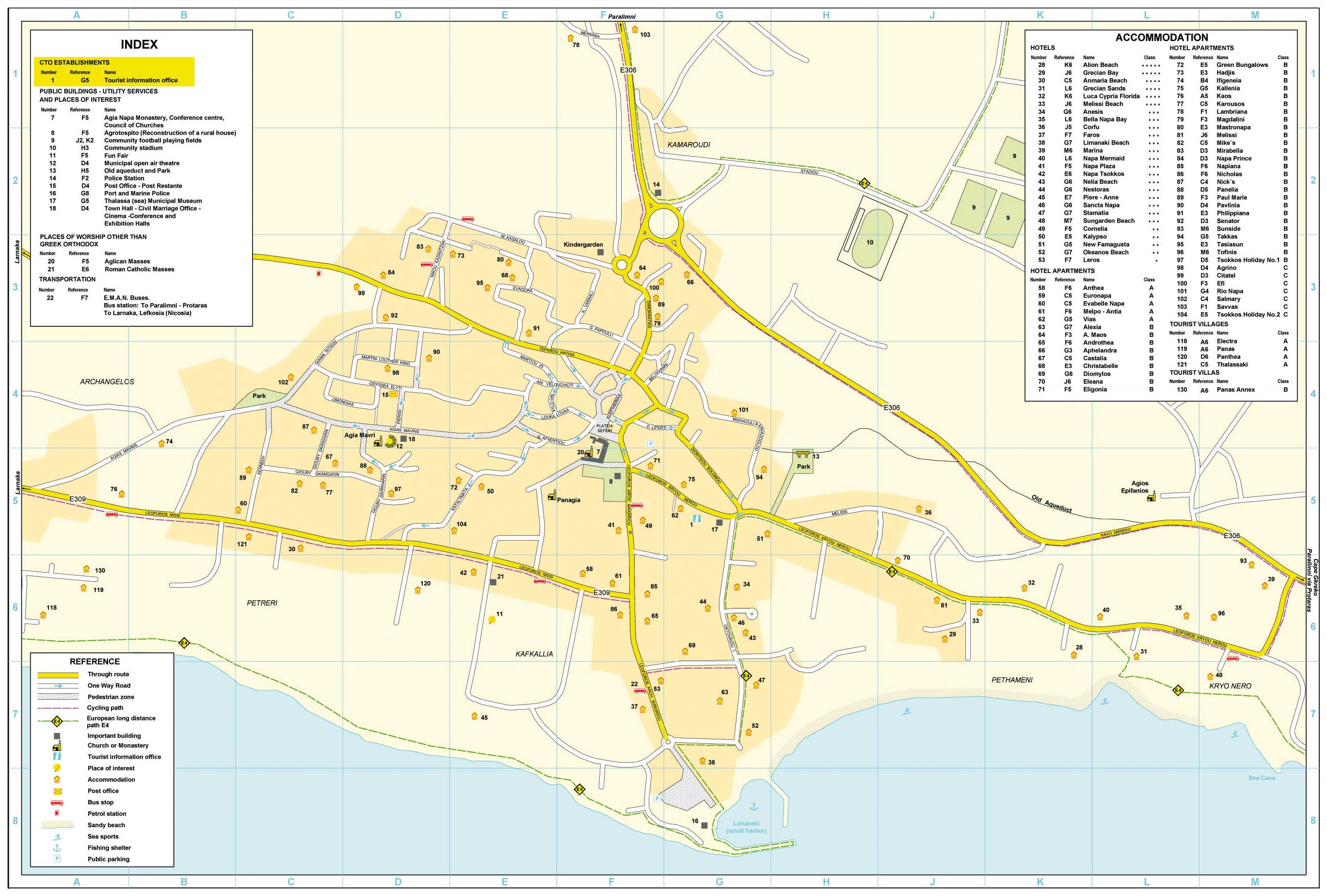
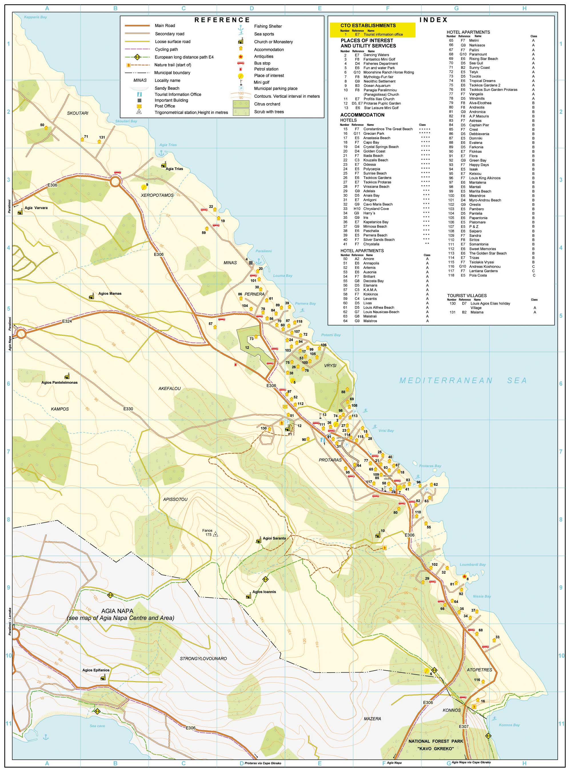
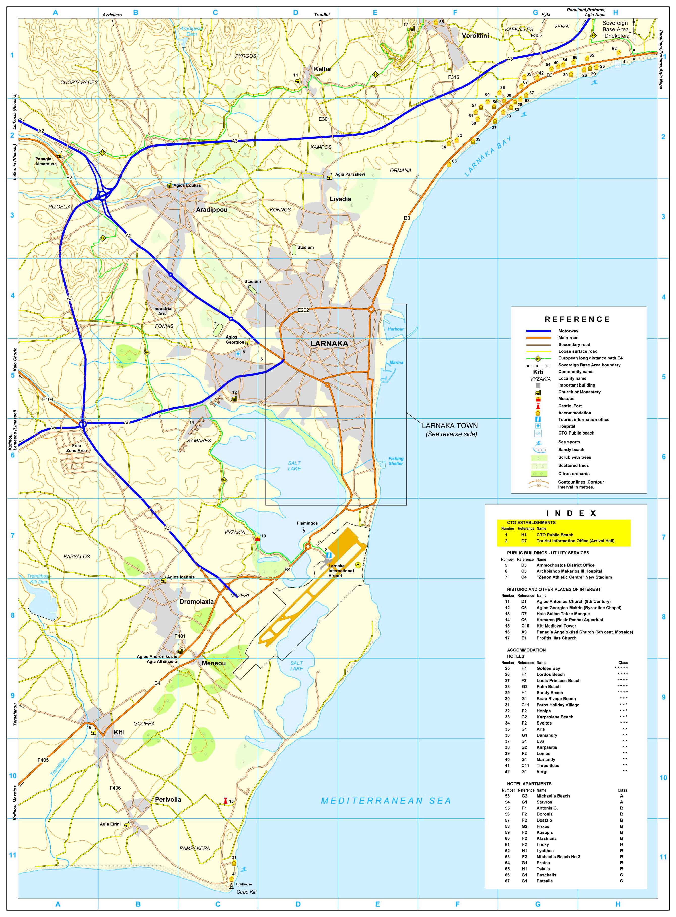
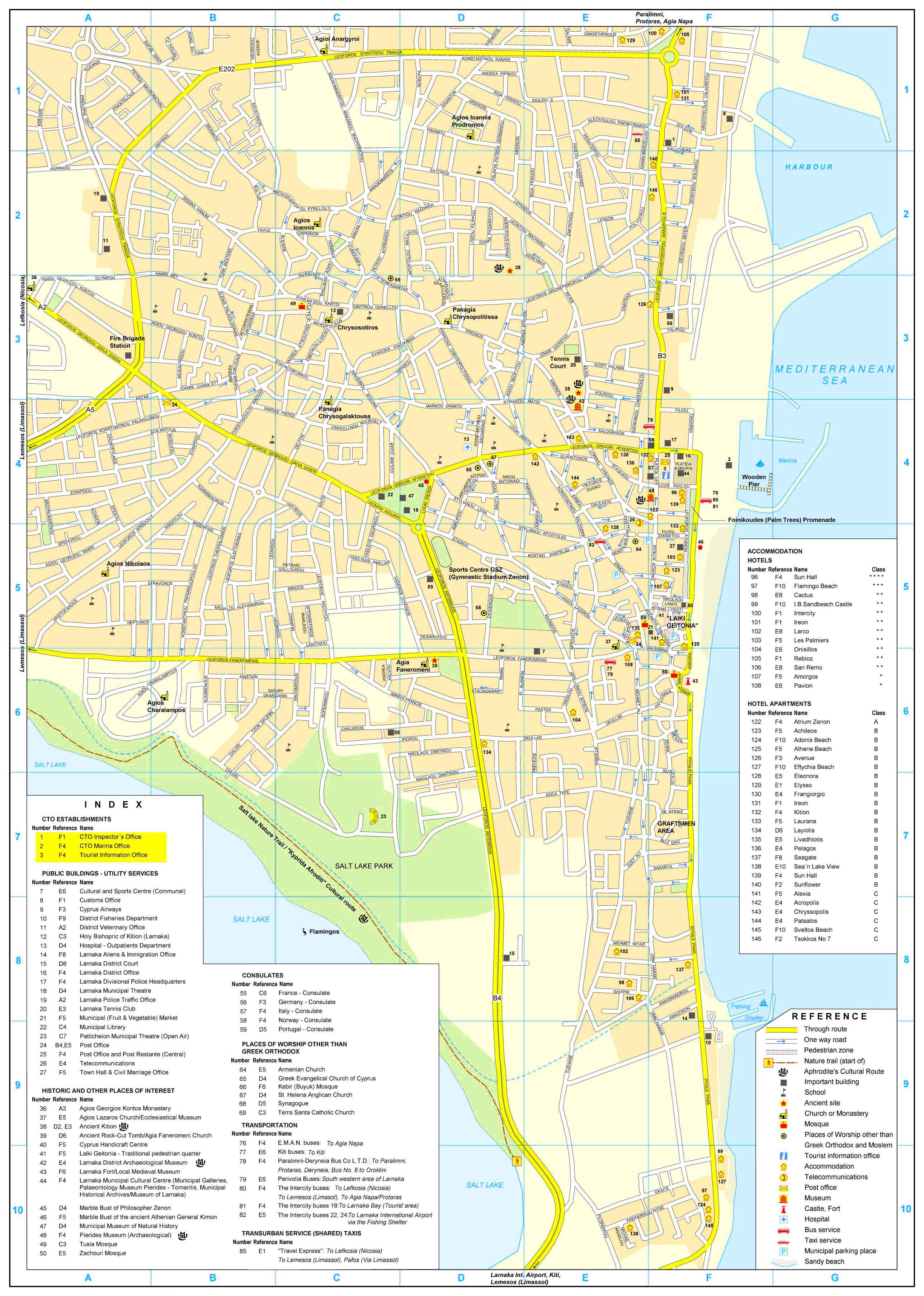
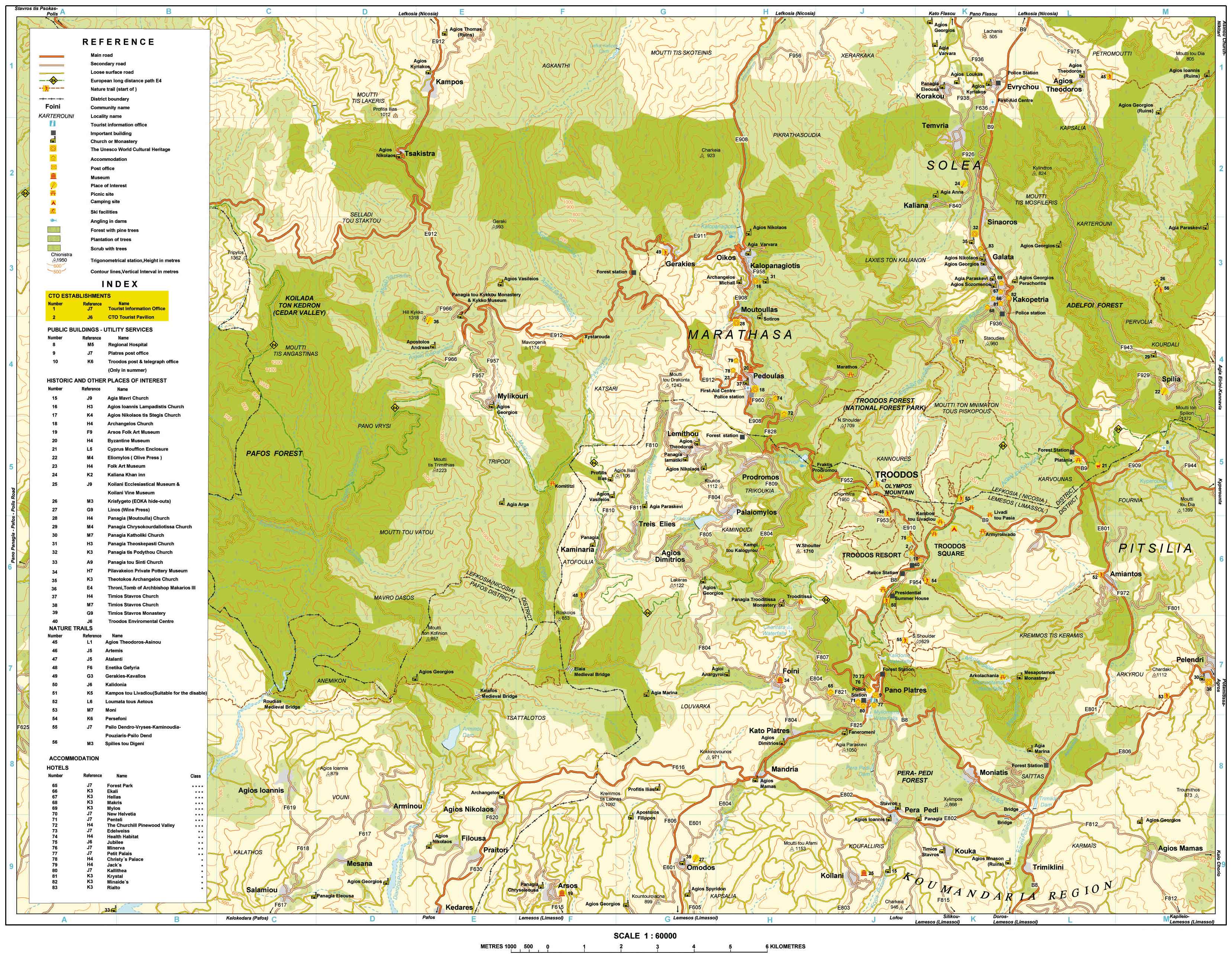
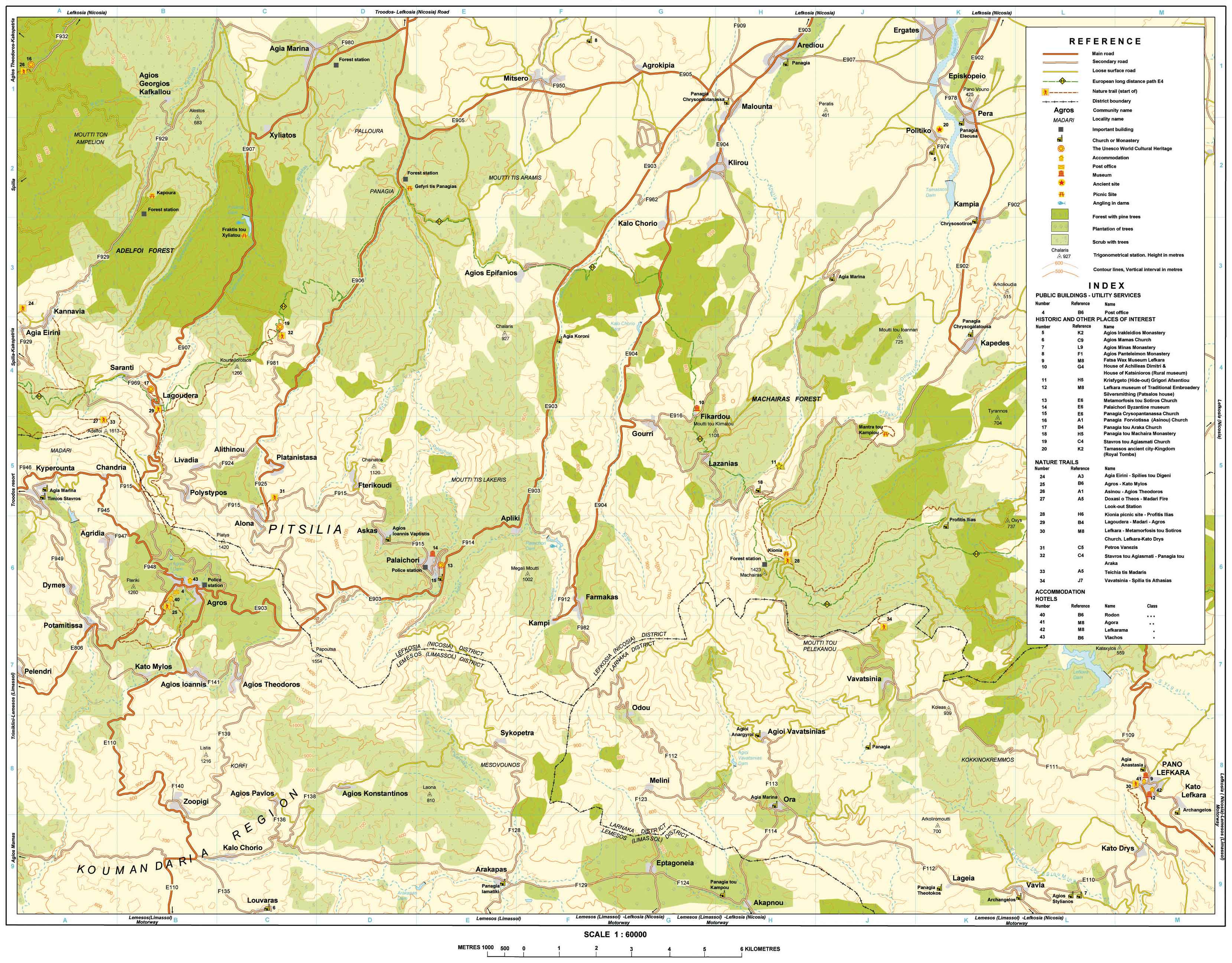
I have all these maps in paper form as well, just in case.